Introduction
One of my favorite hobbies is mountain biking. I try to avoid normal traffic and paved roads and prefer to ride in forests and fields. I plan my routes so that they always include some interesting sections, preferably technical trails. I use a fairly old GPS bike computer for navigation. It's a Garmin Edge 520 with a 2.3-inch color display and OSM map.
In this article, I would like to share some information about planning and navigation.
Planning and Preparation
Sometimes I just get on my bike and ride around my home town. But most of the time I think about a direction or a destination and plan and prepare a route.
To get an idea and inspiration for a direction or a destination, I use various tools. These are the ones I use most often:
- OpenStreetMap
- Google Maps (Satellite, Street View)
- Komoot
And I also use these tools to plan the route specifically. I look for trails, try to avoid roads with car traffic and keep an eye out for interesting places. But when I ride around my home town, this becomes more and more of a challenge. I know this area like the back of my hand. So I try to add variation by putting together the nice route elements.
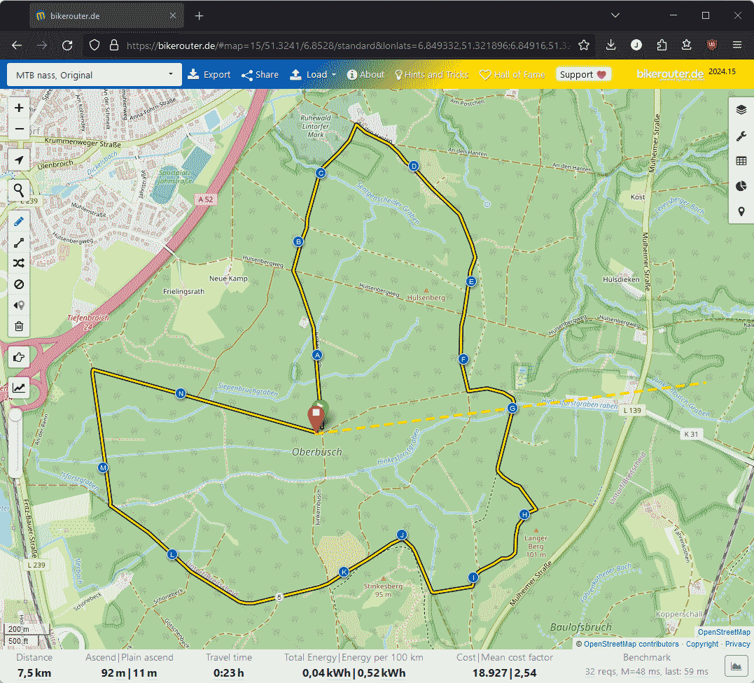
My favorite tool to create a route is bikerouter.de↗. To guarantee the planned route, I set waypoints between intersections so that the navigation has no other choice. Figure 1 shows a brief example of such a route.
When the creation of the route is complete, I download the route in
gpx file format and copy it onto my
bike computer. To do so, I connect the Garmin Edge 520 via USB to my PC and copy
the gpx file to /path/to/my/Garmin/NewFiles and safely eject/unmount
the device afterwards.
I use a specific format for the file names so that I can find and identify
them immediately, for example MTB_2024-05-12_DieHaard.gpx
On the Garmin Edge 520, the new route is then available under Training → Tracks.
Navigation
I don't use navigation in the usual sense, but simply have the route displayed on the map. I therefore have to decide for myself when and in which direction to turn. This works well for me and I'm not annoyed by the beeping or chatter of the device.
Of course, this approach has disadvantages as soon as the route is interrupted by closures or restrictions. Fortunately, this rarely happens to me. In such cases, I help myself with my smartphone and look for alternative short detours. The same applies if I come across interesting places off the route that I want to explore spontaneously.
Conclusion
It's a fusion of technology, sport and adventure. I like planning ahead and I also like shredding the trails with minimal effort to find my way around. It's probably not the most convenient or easiest approach, but it has worked well over the last few years.
Published: